
Kyle ZIP Code Coverage
Kyle’s primary researched postal ZIP is 78640. It is associated with the Kyle postal city and surrounding delivery area, but Kyle postal coverage is not an incorporation map. The Kyle research did not capture an official USPS response that verified a second ZIP for a Kyle address, a station-by-station list, or an official alias result. That gap matters. A Kyle exact address must be checked through USPS before assigning it to a Kyle postal reference.
| ZIP | Areas covered | Post office context | Research note |
|---|---|---|---|
| 78640 | Kyle postal city and surrounding postal delivery area | USPS Kyle delivery context | Primary researched Kyle ZIP; it is not a city-limit boundary |
| Additional ZIPs | Not confirmed in official USPS output reviewed | Not located | Check the exact address rather than inferring a second ZIP |
The official USPS ZIP Lookup offers three different checks: an exact address, a city-and-state association search, and a ZIP-to-city search. They answer different questions. USPS says a result does not confirm that a named person or company is at an address and cannot guarantee actual location. For a Kyle postal question, treat an address result as delivery-format evidence, then compare it with local parcel and jurisdiction records.
Note: No official Kyle ZIP split, realignment, or station-change year was found in the reviewed county and city materials.
Kyle ZIP Postal Search Fields
Hays County’s advanced property search is the local portal that accepts a ZIP range. The Hays Tax Assessor-Collector advanced search can combine low and high ZIP fields with city, street-number range, street name, neighborhood, owner, property type, tax year, subdivision, block, and tract or lot. A ZIP filter returns Kyle property records matching those search fields. It is not a complete list of Kyle residents, because rows can involve vacant land, business entities, exempt parcels, or owners who receive mail elsewhere.
The captured Hays CAD property-search form shows the basic owner, address, street, subdivision, tax-year, and parcel-ID fields that help verify an individual Kyle card after a ZIP filter is run.
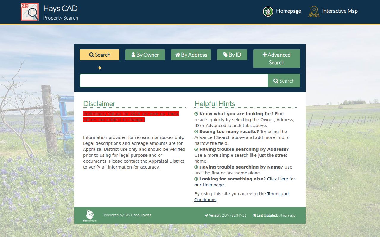
For Kyle ZIP work, the basic form does not expose a ZIP field in the visible group, so the advanced form remains the documented Kyle route for a ZIP-range property search.
| Portal field | Postal-search use | Limit to remember |
|---|---|---|
| ZIP low and high | Set a Kyle property-search range | Postal range does not prove city jurisdiction |
| City | Reduce a broad Kyle postal search | City text may be a postal field |
| Street number and name | Narrow to a specific Kyle address | Use USPS first for delivery format |
| Subdivision, block, tract, or lot | Find the Kyle legal parcel when an address is uncertain | These describe land, not occupants |
| Tax year and property type | Control the Kyle record set returned | Cards and preliminary values can change |
The advanced ZIP-search screen shows the two ZIP fields alongside the city and parcel filters.
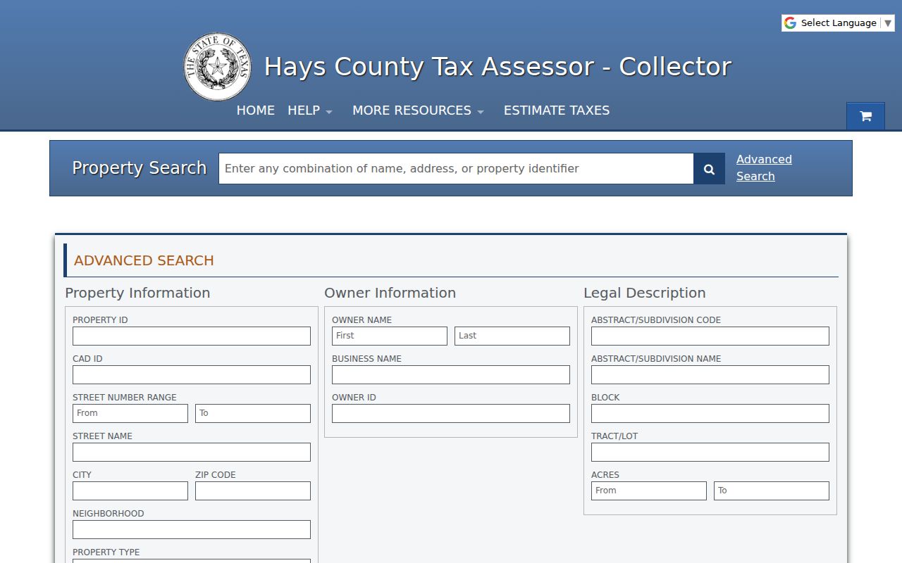
Run a narrow Kyle combination of fields, open the individual CAD card, and retain its situs and legal description before trying to interpret the result.
Verify a Kyle ZIP by Address
Practical tip: use USPS By Address before a city-and-state ZIP search. A Kyle exact query allows a street, city, state, and optional unit or ZIP. If USPS returns multiple possibilities, narrow the street or unit. If it does not return a result, correct spelling and format first. A city-and-state association is broader, and a ZIP-to-city response is not a municipal boundary map.
Address flow: Kyle exact address → USPS delivery format → Hays CAD card → City of Kyle jurisdiction result → Hays GIS parcel check → legal description for deed work. Each step answers a separate question: deliverability, appraisal parcel, city or county authority, parcel geometry, and recorded land identity. Keeping those roles separate is especially useful where Kyle’s growth and annexations meet county and special-district service layers.
The City of Kyle map hub provides an Address Lookup and Jurisdiction Finder intended to return Kyle city jurisdiction, annexation date, voting district, subdivision, and utility provider for an address. Hays County GIS creates and maintains most 911 addresses in the county. Neither tool should be replaced with a postal label when the question is whether a Kyle parcel is inside city limits.
Find Residents in a Kyle ZIP Code
A Kyle postal directory can narrow the geographic portion of a property search, but the resulting cards need individual review. Start with the exact Kyle address if one is known. For a broader property question, use the Hays advanced ZIP fields and then add a street or subdivision. The basic Hays CAD search does not expose a ZIP field in its visible group, so the advanced screen is the documented route for Kyle ZIP-based property filtering.
- Confirm the target Kyle address’s current delivery ZIP with USPS, including any unit or changed street format.
- Search the Hays advanced property form by ZIP, then add Kyle city, street range, street name, or subdivision to reduce the result set.
- Open each relevant Kyle card and compare the situs, mailing field, Quick Ref ID, legal description, and tax year.
- Run the exact address through the Kyle jurisdiction finder and the Hays County GIS portal when city limits, annexation, or parcel shape matter.
- For an individual registration question, use the Hays voter form only with the required name and date of birth or VUID. It has no ZIP input.
Once a Kyle ZIP result has been narrowed to a road and parcel, use the By Street directory for the full address-to-parcel and deed workflow. A postal filter is the beginning of that process, not its replacement.
Note: A Kyle voter query is person-specific and cannot be used as a public ZIP-wide resident browse.
Kyle ZIP Code City-Limit Mismatch
Kyle postal city, Kyle city limit, county responsibility, and special-district service are separate layers. An address can carry a Kyle postal label while the jurisdiction finder places the parcel in county territory. A parcel within Kyle can also be served through county or special-district systems. State the postal and jurisdiction facts separately rather than treating either one as a shortcut for the other.
The Kyle City map’s annexation layer and address finder are the local checks for an exact location. The research did not capture a complete annexation-year table for every Kyle neighborhood, so a ZIP-wide statement about one outlying pocket would overreach. For an individual address, query the City finder and Hays GIS live. The result can identify the current jurisdiction, but not a household’s identity.
Kyle ZIP, Situs, and Mailing Fields
Myth: a Kyle ZIP on a tax mailing address proves the owner or another person occupies the parcel. Hays CAD separates the mailing address, where the tax notice goes, from the situs, the parcel’s physical location. The owner field is for appraisal and tax purposes. A mailing address may point to a different community or an entity address, even when the property’s postal city is Kyle.
Read each Kyle line for its limited meaning. The legal description, often a Kyle subdivision phase with block and lot or a survey and abstract, ties a parcel to recorded land records more reliably than a postal label. CAD values, exemptions, and taxing jurisdictions also have their own functions. They should not be used to infer household composition, personal finances, or continuous occupancy.
- ZIP
- A Kyle postal delivery-area code used by USPS and some local search filters.
- ZIP+4
- An added four digits that help USPS sort Kyle delivery more precisely than the five-digit ZIP.
- PO-box ZIP
- A ZIP used for post-office boxes, which does not establish a physical parcel location.
- Unique ZIP
- A ZIP assigned to one organization or institution, if USPS designates one.
- Carrier route
- A delivery sequence used by postal operations, not a city-limit or resident boundary.
Kyle ZIP History Has No Verified Split
No official Kyle ZIP split, realignment, station change, or alternate Kyle ZIP was located in the inspected sources. No official per-ZIP Kyle population or registration count was located either. That is a real research limit, not a reason to fill a postal reference with third-party estimates or inferred neighborhood lists.
Historic Kyle records may use a rural route, older road label, farm or survey name, or later subdivision name instead of today’s postal format. Kyle’s growth and annexations make that more likely over time. For older Kyle newspaper, telephone, and deed research, retain both the historic wording and the legal description. The current ZIP helps locate a modern Kyle address, but it does not rewrite the historical record.
Kyle Deeds Need Legal Descriptions
For Kyle deed and plat research, a subdivision, phase, block, and lot are often more useful than a postal code. Hays CAD’s card can provide that description, then the Hays County EagleWeb index can be searched by party, date, subdivision, block, or lot. EagleWeb also provides related-document links where instruments share a legal description or reference one another.
Search the current owner as grantee, identify the grantor, and reverse the roles for an earlier transfer. Record the reception number, date, parties, and document type. Public login provides the recorded-document index without images; image and printing access can depend on registration and subscription. If an image is unavailable or an older reference is needed, use the Hays County Clerk counter, phone, or mail route and give the legal description or reception number.
Note: A ZIP is a useful filter, while a legal description is the stronger bridge between a parcel card and a recorded instrument.
Kyle ZIP Code Privacy Limits
A Kyle ZIP-filtered property result cannot reveal every person connected to a postal area. It may include vacant land, exempt parcels, entities, non-owner occupants, or owners who receive notices elsewhere. The Hays voter lookup is not a ZIP search and protected addresses may be suppressed. A missing record can reflect confidentiality, an unmatched query, another jurisdiction, or a different type of record.
Texas confidentiality rules protect categories such as driver-license and identification information, living-person dates of birth, and protected voter information. The Texas Address Confidentiality Program can supply an eligible participant with a substitute address. Use official records for lawful personal, family-history, property, civic, or safety research, and never use location information to stalk, harass, or harm anyone.