
Walk a Kyle Street by Address
Start a Kyle street directory search with the Hays Central Appraisal District property search, not with a name list. The Kyle card joins a physical parcel, its legal description, an owner field, and sometimes a tax-notice mailing address. That Kyle combination gives a stronger starting point than a road name alone. A current Kyle card can still lag a recorded transfer, and it does not identify every person who may live at the situs, the physical property location.
Keep the Kyle street spelling and tax year with every result. Hays CAD specifically suggests a street-name-only search when Kyle address formatting fails. Add a number, city, ZIP, subdivision, or property type only after the broad street result is manageable. That small adjustment is useful on Kyle streets with unit numbers, recent construction, or inconsistent suffixes.
- Search the Kyle street name in Hays CAD, then narrow with a street number or advanced fields only when needed.
- Open the selected Kyle parcel card and save the Quick Ref ID, Geographic ID, situs, mailing field, subdivision, and legal description.
- Check the Kyle parcel in the City of Kyle map hub or Hays GIS to separate the postal address from the city or county jurisdiction.
- Search the current Kyle CAD owner as grantee in the Hays County EagleWeb recorded-document index, then follow the prior grantor backward.
- Use a matched individual’s voter confirmation only when name and date of birth or VUID are legitimately available. Historical Kyle household questions belong with the local-history collections, not a streetwide voter guess.
Note: Save the Kyle search date because Hays CAD displays preliminary values and its cards can change with tax-year updates.
Kyle Street Directory Search Fields
The Hays CAD form is Kyle’s main address-keyed tool for a street directory. Its basic screen accepts owner name, street number, street name, Quick Ref ID, subdivision, owner ID, tax year, neighborhood, and several other fields. The advance route at the Hays County Tax Assessor-Collector search adds number ranges, city, ZIP low and high fields, block, tract or lot, acreage, and a result-sort control. These are Kyle parcel filters, not a household roster.
| Hays CAD field | Use on a Kyle street | How to read it |
|---|---|---|
| Street Name | Find the normalized road form first | Use alone when a full address fails |
| Street Number | Narrow a long Kyle street result | Pair after checking the street-name result |
| City and ZIP range | Limit a Kyle advanced property search | Postal text is not city-limit proof |
| Subdivision, block, lot | Bridge a Kyle parcel and recorded plat | More stable than a changed street label |
| Quick Ref ID or Geographic ID | Keep one Kyle parcel distinct from another | Neither replaces a reception number |
The captured Hays CAD property-search form shows the field choices used for Kyle street work.
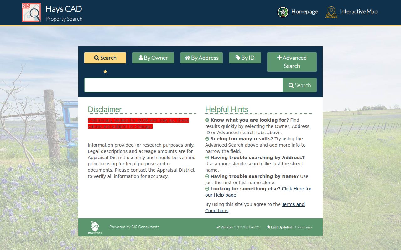
Use the Kyle form to produce a bounded set of Kyle parcel cards, then inspect each card rather than treating the first result as a resident match.
Map Kyle Parcels Before Deeds
A Kyle street address is useful, but the map and legal description make a Kyle parcel easier to distinguish from a nearby lot. The City of Kyle Address Lookup and Jurisdiction Finder is intended to return jurisdiction, annexation date, voting district, subdivision, and utility-provider information for an exact address. The Hays County GIS open-data portal and the Hays CAD viewer add the parcel side of that check.
Search a Kyle address or parcel, zoom to the street segment, record the identifier and legal description, then open the CAD card. Compare Kyle neighboring lot geometry only after confirming the map’s date and visible labels. The research capture did not expose every live GIS layer, click field, buffer, or export control, so verify the available controls in the live map before relying on them.
- Parcel
- A defined piece of Kyle land recorded and tracked for appraisal or mapping purposes.
- Situs address
- The physical location shown for a Kyle parcel on the CAD card.
- Plat
- A recorded map that lays out a Kyle subdivision, roads, blocks, lots, and sometimes easements.
- Criss-cross directory
- A historical reverse directory arranged by a Kyle address rather than by a person’s name.
For older occupants rather than a current parcel question, the historical routes are described with the Kyle materials in the City Directories collection.
Kyle Street Records Compared
Address-keyed sources answer different questions along the same Kyle street. CAD is best for the Kyle appraisal owner and parcel context. Kyle GIS is best for the lot shape and local jurisdiction. EagleWeb tracks recorded instruments. Kyle city systems can provide existing permit or public code-case records through their own routes. The voter form has a narrower role: it confirms a matched person and precinct, not every person associated with an address.
| Street record | Kyle or Hays keeper | Useful result | Access channel |
|---|---|---|---|
| Parcel card | Hays CAD for Kyle | Owner, situs, mailing field, legal description | Free web search, phone, data downloads |
| Parcel map | Kyle, Hays CAD, County GIS maps | Geometry, IDs, jurisdiction, layers | Interactive map or open-data route |
| Deed or plat | Hays County Clerk for Kyle | Parties, legal description, reception data | Public index, registered-image access, counter, mail |
| Permit or inspection | City of Kyle | Existing construction and inspection milestones | CSS workflow or narrow PIA request |
| Voter confirmation | Hays Elections for Kyle | Matched person’s registration or precinct context | Name and DOB or VUID and DOB form |
When an online document image is unavailable, the County Clerk Records Division in San Marcos and the Precinct 2 substation in Kyle are in-person routes for Kyle records. Mail or phone requests work better with a reception number, party name and date, book and page, or legal description. Hays County also accepts a narrow Texas Public Information Act request for existing county records that are not otherwise available.
Note: A tax card, map label, and recorded document should be compared, because each is created for a different purpose.
Kyle Mailing and Situs Fields
Myth: a mailing address on a Kyle property card proves that a person lives at the parcel. Hays CAD’s own Kyle field pattern separates the mailing address, where a tax notice is delivered, from the situs, where the parcel is located. The owner field is an appraisal and tax-roll field. A Kyle mailing address can be outside the situs community, and an entity owner may use an office or agent address.
Read those Kyle fields separately. The mailing and situs fields can match, but a match still does not establish every household member or the date someone moved in. Hays CAD also cautions that not all exemptions appear online. A classification or exemption marker is tax context, not a complete occupancy history. This Kyle distinction prevents a street directory from overstating what the underlying public record says.
Kyle Deed Trails by Legal Description
After locating the Kyle parcel, EagleWeb provides the Hays County Clerk’s recorded-document index, with recorded documents stated as beginning August 24, 1848. That long Kyle record index is a catalog, not a title guarantee or a promise that every underlying image is viewable online. Public login permits searching the index without images; registered access and subscription type affect image viewing and printing.
Search the current Kyle CAD owner as a grantee over a reasonable recent date range. Capture the reception number, instrument date, grantor, grantee, document type, and legal description. Next, search the seller or grantor as an earlier grantee. EagleWeb supports Grantor, Grantee, and combined role searches, plus dates, document types, subdivision, block, lot, wildcard syntax, and related-document links. Legal-description searching is the best safeguard against a same-name party or a nearby lot.
The Hays County deed-index entry point is shown in this capture.
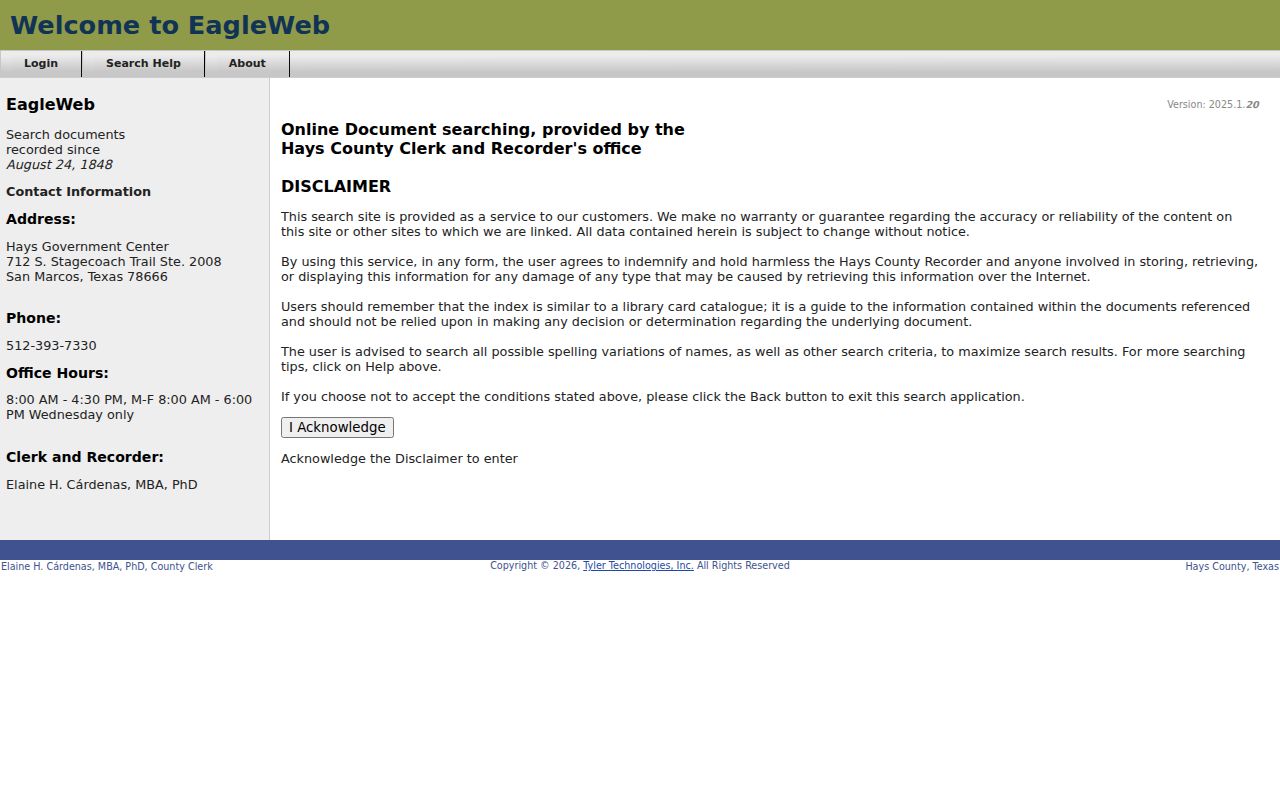
If the chain ends at an older book reference or unavailable image, ask the County Clerk about a counter search, copy, or certified-copy procedure rather than guessing from the index.
Kyle Address Permits and Requests
Kyle permits add a time layer to an address, but they do not turn a street search into a resident list. Kyle’s public building pages describe the CSS permit, inspection, plans, and payment workflow. For a record that is not displayed online, send a focused request through the City of Kyle public-information request route. Identify the address or parcel, date range, and the existing record type requested.
A useful Kyle request can ask for existing building permits, inspection records, Certificates of Occupancy, and public final-inspection information, including permit number, type, status, and final inspection if public. Ask separately for public code cases. Kyle Code Enforcement distinguishes municipal enforcement from private deed restrictions, so a private covenant question does not become a city case merely because it concerns the same street.
For Kyle county-held material, Hays County’s GovQA, email, mail, fax, and hand-delivery PIA channels are alternatives to a portal search. A request should describe existing records, not ask an office to create a new street report or answer open-ended research questions.
Kyle Voter Lookup Is Not Streetwide
The Hays County Voter Registration and Precinct Lookup is designed for one Kyle person at a time. Its modes require a matching first and last name with date of birth, or a 10-digit VUID with date of birth. A failed match can reflect certificate spelling, punctuation, a former name, a move, another county, or address protection. It is not evidence that someone never lived in Kyle.
For a Kyle voter record, Texas Election Code chapter 18 makes specified voter information public while confidentiality protections still apply. A broader voter-file request follows the Texas Secretary of State’s current request form, filters, and use terms; Hays’s individual form does not provide a public street browse. Protected addresses and people who are not registered will not be supplied by an ordinary name-and-date query.
The Hays voter lookup screen illustrates the two exact-match paths.
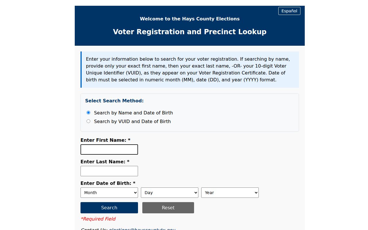
Kyle searchers can use the Hays Elections Office for correction or access questions, and should retain the lookup date because election records change.
Note: Participation history means elections voted, never a record of ballot choices.
Kyle Street Names Need Dates
Kyle street labels change. In September 2025, the city officially renamed the affected South Goforth Road segment Chevo Pastrano Senior Parkway after an August 2025 Council action. The city stated that the segment had no active addresses, yet the old and new names remain useful search bridges for nearby deed and newspaper work. Search both names when the corridor is relevant.
No official Kyle-wide street-renumbering project or year was located in the research. Do not invent one to force a modern address onto an older document. Use subdivision, phase, block, lot, survey, abstract, or an older road label alongside the date. The legal description often holds the thread when a street address has changed format.
Note: Keep an old street name and the current name in separate fields so the date of each reference stays clear.
Kyle Street Directory Privacy Limits
A Kyle public parcel map cannot show who is inside every building, who visits, utility customers, delivery history, or protected residents. A permit applicant, contractor, code complainant, or registered agent should not be relabeled as a resident. Likewise, a map label or owner field should not be treated as a full household list. Use the record only for the limited fact it actually supplies.
Texas confidentiality rules can restrict living-person dates of birth, driver-license and identification information, juvenile records, protected voter addresses, and other sensitive fields. The Texas Address Confidentiality Program can provide a substitute address for eligible participants. Missing information may be protected, not absent.